Trump and the Hurricane Dorian map
Copyright © 2019 — Creative Commons Attribution-NonCommercial 4.0 International License
After 6 days, we may have the whole "SharpieGate" story.
On Sunday Sep 1, President Trump tweeted:
In addition to Florida — South Carolina, North Carolina, Georgia, and Alabama, will most likely be hit (much) harder than anticipated. Looking like one of the largest hurricanes ever. Already category 5.
The NWS in Birmingham immediately tweeted in response:
Alabama will NOT see any impacts from #Dorian. We repeat, no impacts from Hurricane #Dorian will be felt across Alabama. The system will remain too far east.
On Wednesday Sep 4th, Trump defended his Alabama forecast by displaying a map showing the storm track of Hurricane Dorian, famously modified with a black marker pen to show the storm track continuing into Alabama. In the southeast we see the current position of Dorian, labeled "11 AM Thu". So Trump was displaying a forecast that was already 3 days out-of-date when he made his Sunday tweet.
The question, then, is: did his Sharpie edit correctly indicate the forecast as it stood on Sunday? We can check that on NOAA's archive.
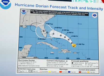
If you check the archive, at no time did NOAA issue a map that looked like Trump's Sharpie-modified version. So was there any other justification for Trump's Alabama forecast?
NOAA says "yes". On Friday Sep 6th, they issued a statement saying:
From Wednesday, August 28, through Monday, September 2, the information provided by NOAA and the National Hurricane Center to President Trump and the wider public demonstrated that tropical-storm-force winds from Hurricane Dorian could impact Alabama. This is clearly demonstrated in Hurricane Advisories #15 through #41, which can be viewed at the following link.
The Birmingham National Weather Service’s Sunday morning tweet spoke in absolute terms that were inconsistent with probabilities from the best forecast products available at the time.
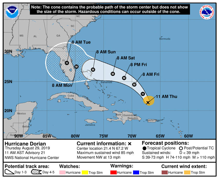
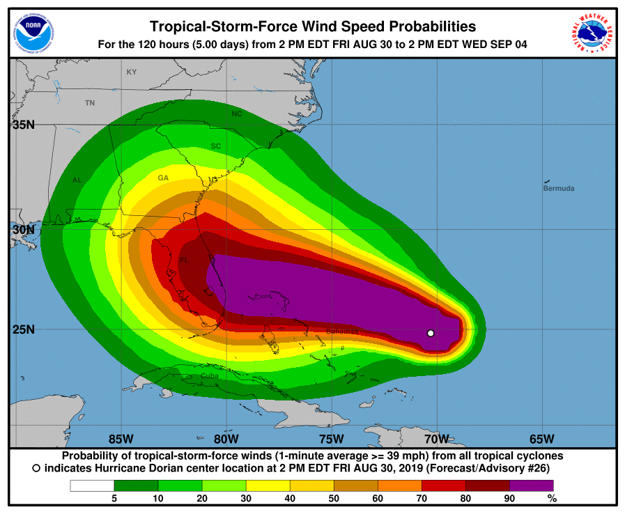
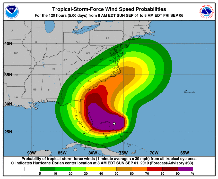
Take a look at their link, which displays forecasts at 6-hour intervals starting the morning of Saturday Aug 24th. NOAA is correct that the forecasts showed an "impact" in southeastern Alabama up through their Tuesday Sep 3rd forecast. However, by Saturday morning Aug 31st, forecasts were clearly showing that the bulk of the impact would make a right turn and proceed up the Atlantic coast, with only a fringe of tropical storm conditions brushing Alabama.
So NOAA's criticism of the Birmingham NWS is technically correct: Birmingham said "no impacts" but they should have said "less than 10% chance of impacts". Right.
My conclusion: Trump was negligent in including Alabama in his Sunday warning tweet, based apparently on forecasts from Thursday and Friday. His error is not explained by his own after-the-fact justifications, nor by NOAA's supportive statement. Trump screwed up, and if he had just admitted that, it would have been classed as a minor error and been forgotten. Instead, it's become another example of his utter unwillingness to admit fallibility, and it has allowed NOAA to make themselves look incompetent.